Cass County Illinois Hunting Ground — The Overlooked River County
What Cass County Is and Why It Does Not Get the Attention It Deserves
Pike County gets the headlines in Illinois hunting land. The bluff-country river timber, the trophy buck reputation, the out-of-state buyer demand — Pike has been the default answer to "where do you go for world-class Illinois whitetail hunting" for two decades. That reputation is earned. But it has also pushed Pike County per-acre prices to levels that close out a significant segment of buyers who would be very well served by the terrain directly to the north.
Cass County sits along the Illinois River between Mason County to the east and Schuyler County to the west. Beardstown is the county seat. The county covers roughly 375 square miles of river bottom, upland timber, and agricultural ground that produces deer as consistently as any piece of western Illinois terrain — with per-acre pricing that still reflects its relative lack of marketing rather than its actual hunting quality.
Buyers who have been priced out of Pike County, or who are finding that available Pike County parcels at current prices require a level of investment they cannot justify, should be looking at Cass County. The terrain is different — less dramatic bluff-country relief, more river-bottom character — but the deer are there, the turkey are there, and the waterfowl opportunity along the Illinois River is a significant bonus that Pike County timber ground often lacks.
The Terrain — What Cass County Ground Actually Looks Like
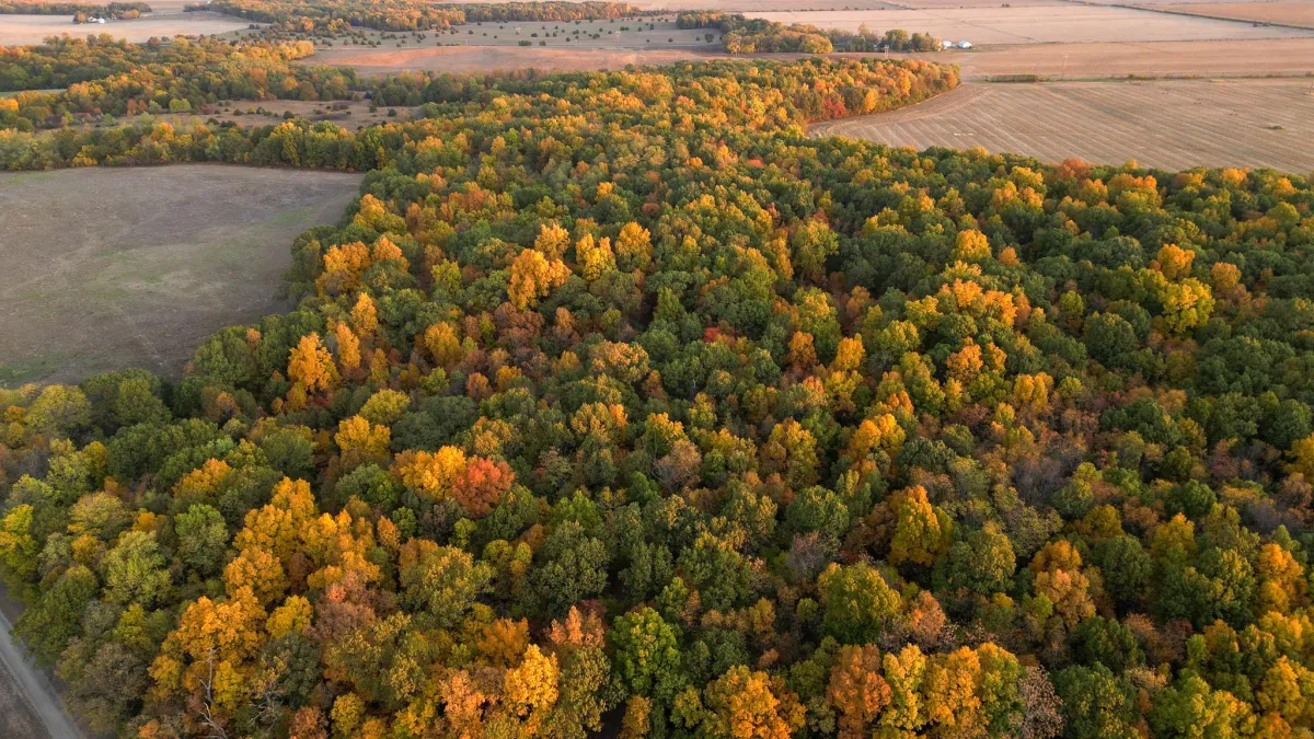
The Illinois River forms the western boundary of Cass County, and the flood plain and backwater timber along that corridor define the county's best hunting terrain. River-bottom whitetail habitat in Cass County means mature cottonwood and silver maple timber interspersed with agricultural edges, backwater sloughs that concentrate deer movement during the rut when bucks are covering ground, and natural pinch points created by creek drainages entering the main river channel.
The Sanganois State Fish & Wildlife Area covers a significant portion of southwestern Cass County — roughly 13,000 acres of public land along the Illinois River backwaters. That public land presence is a double-edged consideration for buyers. It draws hunting pressure that can push deer movement in ways that benefit adjacent private ground, but it also creates competition from hunters accessing public land near private parcel boundaries. Properties that back to Sanganois with private access and controlled pressure can be exceptional hunting operations.
Moving east from the river, the terrain transitions to rolling upland — less dramatic than the Pike County bluffs, but carrying the creek-bottom timber, brushy draws, and agriculture-to-timber transitions that produce consistent deer in central and western Illinois.
What Deer Hunting Actually Looks Like in Cass County
Cass County produces mature deer. The county does not appear consistently on state-level trophy buck lists the way Pike or Adams do, partly because the hunting pressure is lower and partly because the hunting tourism infrastructure that concentrates attention on western Illinois bluff country has not developed in Cass County to the same degree. What that means practically is that the deer-to-hunting-pressure ratio in Cass County has historically been favorable for landowners who manage their ground intentionally.
The Illinois River corridor concentrates deer movement during the rut in ways that give Cass County properties along or near the river a genuine advantage. Bucks running river-bottom terrain during November cover significant ground in a short period, and properties positioned along movement corridors between bedding timber and agricultural feeding areas along that corridor see consistent rut activity. Trail camera surveys on well-positioned Cass County ground routinely show mature buck activity that would not surprise a Pike County landowner.
Turkey hunting in Cass County benefits from the same river-bottom timber that holds deer — mature hardwood stands with good mast production, open river-bottom flats, and agricultural edges provide the habitat mix that supports a huntable turkey population throughout the county.
Per-Acre Pricing — What Cass County Ground Is Trading For
Cass County hunting ground has been trading in a significantly lower range than comparable Pike County terrain. River-bottom timber in Cass County with strong deer sign, controlled access, and good field-edge hunting has been moving in the $2,800 to $4,200 per acre range in recent sales activity, depending on the specific combination of timber quality, tillable acreage, water features, and improvements. Ground without meaningful tillable acreage or with access limitations trades toward the lower end of that band.
Compare that to Pike County timber with comparable hunting quality, which has been trading at $4,500 to $7,000 per acre in recent competitive sales, and the Cass County discount becomes concrete. A 160-acre parcel in Cass County with good river-bottom timber and field-edge hunting opportunity might be acquired for $450,000 to $600,000. A comparable parcel in Pike County would likely start above $700,000 and could push past $1 million on competitive ground with a documented trophy buck history.
For the buyer whose primary goal is owning huntable Illinois ground — not paying a premium for marketing reputation — Cass County represents a legitimate value proposition that the current market has not fully priced.
What to Look for in a Cass County Hunting Tract
The same evaluation criteria that apply to any western Illinois hunting land acquisition apply in Cass County, but a few specifics deserve attention. Flood plain ground along the Illinois River bottom is subject to periodic flooding, and any parcel with significant acreage in the FEMA flood zone requires an honest assessment of what that means for improvements, access during wet years, and insurance cost. The hunting value of flood plain timber is real — flooded timber attracts ducks and concentrates deer movement — but the infrastructure limitations of flood-prone ground are equally real.
Check access carefully. Some Cass County properties with excellent hunting terrain have access constraints — landlocked parcels, shared road easements, seasonal road conditions — that affect how the ground functions as a hunting property in practice. Walk the access route in person before you make an offer.
The Sanganois boundary is worth verifying on any property in southwestern Cass County. Understanding where the public land begins and ends, and how that boundary relates to the private parcel you are evaluating, is relevant context for both hunting pressure management and for understanding the deer movement patterns across the property.
Jared Williams is the Managing Broker and owner of Archer Realty & Auction LLC. He spent 13 years as a producer for the Outdoor Channel before returning to Illinois to build a land brokerage with operator-level expertise in recreational real estate across central and western Illinois. Start the conversation at archerrealty.net.